AI-Powered GDE Mapping & 3D Geospatial Conversion
Transform Any Map into an Intelligent 3D Geospatial Environment
At SDE Digital Ventures, we are redefining how organisations visualise and interact with spatial data. Our solution transforms conventional 2D maps, engineering drawings, satellite imagery, CAD layouts, BIM models, drone imagery, and GIS datasets into immersive, geospatially accurate 3D Digital Environments (GDE).
Preserving Real-World Geospatial Intelligence
Unlike conventional 3D modelling, our platform preserves geospatial intelligence by maintaining real-world coordinates, positioning, orientation, and spatial relationships.
This enables seamless integration with GIS platforms, Digital Twin ecosystems, Smart Cities, utilities, infrastructure management, and industrial operations.
Weeks to Automated Workflows
Powered by AI, our solution reduces weeks of manual modelling into an automated workflow while maintaining engineering accuracy.
Turn Raw Spatial Data into Actionable Insights
Whether planning a smart city, visualising critical infrastructure, monitoring industrial assets, or building an enterprise Digital Twin, SDE delivers an intelligent geospatial platform.
GIS & Digital Twin
Full coordinate retentionMulti-Source Input
CAD, BIM, Satellite, DroneAccelerated AI Speed
Rapid automated conversionEngineering Grade
High spatial precisionFull Video Showcase
Experience how 2D engineering layouts and spatial datasets are transformed into live 3D Geospatial Environments.
Key Features
2D to 3D Conversion
AI-assisted automated conversion from 2D maps into 3D geospatial models.
Coordinate Referencing
Preserves real-world GPS, GIS, and spatial coordinate positioning accuracy.
GIS & Digital Twin
Seamless integration with enterprise GIS platforms and Digital Twin ecosystems.
Terrain & Infrastructure
High-precision modelling for complex terrains, structures, and utility assets.
Asset Digitalisation
Transform physical facilities and buildings into interactive 3D digital assets.
Multi-Format Support
Supports CAD drawings, BIM models, drone surveys, and satellite imagery.
Interactive 3D View
Real-time rendering, pan, zoom, and layer management for decision-makers.
Enterprise Scalability
Secure, cloud/on-premise deployment designed for large-scale operations.
Industry Applications
Smart Cities
Manufacturing & Industrial
Upstream Oil & Gas
Utilities & Energy
Transportation & Rail
Construction & Infrastructure
Environmental & Land Mgmt
Defence & Security
Government & Authorities
SDE SMART BOT
Not just a chatbot. Not just an FAQ engine.
A 24/7 AI employee for your organisation.
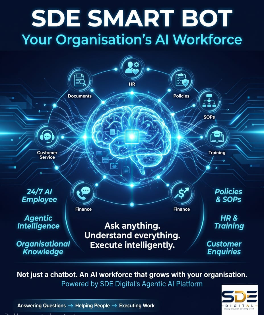
Your Organisation's AI Workforce.
Most conventional chatbots are designed around a limited set of predefined questions and answers. When the question falls outside their programmed scenarios, the conversation often ends with: "Sorry, I don't understand your question."
SMART BOT is built differently. Powered by our Agentic AI Platform, SMART BOT is designed to interact with your organisation's knowledge, policies, documents, processes and information — allowing employees, customers and stakeholders to engage with your organisation through a natural, intelligent conversation.
Think of it as having your own organisation-specific AI platform — similar to the experience of ChatGPT or MASZA, but built around YOUR organisation.
🧠 Ask Anything About Your Organisation.
Employees and users can ask questions naturally — without having to know where the information is stored or which department owns it.
SMART BOT can help users find and understand the information they need — 24 hours a day, 7 days a week.
🤖 More Than Answers — Agentic Intelligence
Its Agentic AI architecture can be configured to reason through requests, use organisational knowledge, connect with approved systems and support business workflows.
🏢 Your Organisation. Your Knowledge. Your AI.
Every organisation is different. SMART BOT can be customised around your: Knowledge + Policies + Processes + Data + Brand + Business Rules.
🌐 Like Having Your Own AI Platform
Imagine giving every employee access to an AI assistant that understands your organisation — instead of searching through hundreds of pages, PDFs, emails, portals and SOPs.
⚡ From Chatbot to Digital Workforce
SMART BOT can become the front door to your organisation's AI ecosystem — today answering questions, tomorrow retrieving information, initiating processes, generating reports and performing approved tasks.
Your Organisation's AI.
Your Knowledge.
Your Digital Workforce.
Ready to Digitalise Your Spatial Assets?
Schedule a session with our Geospatial AI specialists to transform your 2D drawings into intelligent 3D environments.
Request a Consultation